Horní Planá
Náměstí 54
38226 Horní Planá
Contact: Jiří Hůlka
Telephone: +420 380 738 107
Fax: +420 380 738 320
E-mail: starosta@horniplana.cz
WWW: www.horniplana.cz
Location: Region of Český Krumlov
Municipal office
Basic information
Geographical area : 9925 ha
Altitude : 781 m above sea level
Parts
Horní Planá
Bližší Lhota
Hodňov
Hory
Hůrka
Olšina
Pernek
Žlábek
Town History
Origin of the Name :
in Latin texts: Plana de Monte Vitconis
in German texts: Plan, Oberplan
The first written mention of the town is from 1332. The original owner is the Zlatá Koruna Monastery, and received township status in 1349. During the Hussite wars this town, like other towns subject to the monastery, became the property of the Český Krumlov dominion and remained there until the end of feudalism.
Local Historical structures
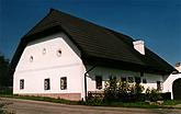
Home of Adalbert Stifter (no. 21) - two memorial plaques on both sides of the entrance. The interior has been made into a museum for the writer (branch of District Museum of National History in Český Krumlov).
Dobrá Voda - chapel of the Grievous Virgin Mary - built in late Gothic style in 1777 - 1779
Church of St. Markéta - first mention in 1374. Originally Gothic structure from the late 13th century, reconstructed in 1694 - 1696 and in 1708. On the exterior are Renaissance paintings from around 1520.
Nature
The town lies on the shore of Lipno dam, and nearby lies Olšina - the highest situated lake in the Czech Republic. Around the lake lies an educational Adalbert Stifter´s Route.


