Zlatá Koruna
Zlatá Koruna
38101 Zlatá Koruna
Contact: Milan Štindl
Telephone: +420 380 743 119
Fax: +420 380 743 223
E-mail: ou@zlatakoruna.cz
WWW: www.zlatakoruna.cz
Location: Region of Český Krumlov
Municipal Office
Basic information
Geographical area : 881 ha
Altitude : 473 m above sea level
Parts
Zlatá Koruna
Plešovice
Rájov
Town History
Origin of the Name :
1263 - Sancta Corona
1350 - Heiligen Chron
1414 - klášter Svaté Koruny
1609 - Zlatá Koruna
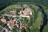
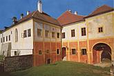
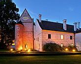
The first written mention is from 1263. The monastery was built by King Přemysl Otakar II had the monastery built to protect his interests from the Vítkovci family entering into inner Bohemia. Several supporters devoted large swaths of land and other property to the monastery, and in the days of its blossom, its dominion stretched from České Budějovice all the way to the borders. After the death of Přemysl Otakar II, the monastery was destroyed by the Kumans even before it could be completely built. From 1281 to 1291 the abbey was rebuilt with the help of King Václav II. The monastery burned down in 1354, but was again rebuilt. During the Hussite Wars it was stormed twice and ransacked. Then a sizable part of the monastery's property was taken by the Rosenbergs. The abbey and monastey were dissolved by Emperor Josef II in 1785. The outer parts of the monastery were made a village in 1785, then a fully independent township in 1848. Later a military bleaching works, then a silk factory, a pencil factory, a cardboard press, a drapery works, a machine works, and finally a foundry all occupied the halls of the monastery. Various sorts of economic problems brought the end to all industrial activity there in 1909. Finally, shortly after 1945, most of the renewed areas of the monastery were once again made accessible to the public.
Nature
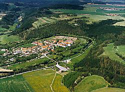
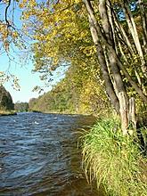
The town is situated in the Blanský Forest Nature Reserve at the base of Kleť Mountain. Perceptive visitors of Zlatá Koruna will notice especially the genius loci. The impression of the town is deepened by the beautiful landscape formation formed by the flow of the Vltava River on three sides.
