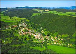
Věžovatá Pláně - Rožmitál na Šumavě - Zátoň, 23 km
Location: Region of Český Krumlov
Type: Hiking trails
Lenght of route: 23 km
Time: 6 - 8 hours
From Věžovaté Pláně on the red line in the direction of Kaplice - through the forest to the destroyed village Rojov - in front of the ruins right to the non marked path, and on it to the road - left to the area of the destroyed village Zahrádka (sign posts on the linden tree), continue on the blue line via Močerady to Rožmitál na Šumavě - at the top end of the village turn left on to a unmarked path, which leads through Čeřín to the Vltava river - in front of the bridge turn right, on the red line to Zátoň.
Attractions: hill Kraví hora and Křížová hora, church in Zátoň
Not Found
The requested URL /iscrck/php/katalog/atr/cenik_ukaz.php was not found on this server.
Apache/1.3.29 Server at localhost Port 80

